
Walk a Caldwell Street Record
Use one full address to build the street record, then keep the physical address, mailing address, parcel number, and legal description in separate notes. The physical or situs address is the parcel location. The mailing address is only where assessment mail goes. Canyon County may show a person, trust, estate, or company as owner, but that label alone does not establish who occupies the site.
The most reliable Caldwell street directory sequence moves from the parcel to dated evidence. Each step answers a different question, and no single source should be asked to prove more than it records.
- Run the number and street name through the Canyon County Assessor Property Search. Copy the owner, parcel ID, short legal description, and last-transfer date and instrument.
- Open the Canyon County GIS viewer. Inspect the parcel, nearby lots, city boundary, and land-use context.
- Use the instrument and current party in the Recorder Search. Follow the same legal description through earlier deeds.
- Check the lawful voter route for a dated registration clue. An individual lookup is not a whole-street roster.
- For older occupants, consult telephone books and city directories through Caldwell, state, and university collections.
This chain makes by-address results easier to audit. If a name conflicts, return to the legal description and recording date instead of assuming the closest match is right.
Caldwell Street Directory Parcel Search
PublicAccessNow is the practical first stop for a current Caldwell parcel. Guest access supplies ownership, assessed value, parcel number, short legal description, lot size, and the last transfer date and instrument number. A free registered account adds taxes due, value history, ownership history, and building traits. The portal advises using fewer address terms for broader results and spelling the street fully for a specific result.
The visible controls matter because a street suffix or directional can block a sound match. Search the street number and name without the directional or suffix when the exact form is uncertain, and switch the search type to Contains. A wildcard is accepted in the main search. Owner and legal-description criteria belong to the registered route, so they should not be treated as open guest fields.
| Portal field | How it works | Caldwell search note |
|---|---|---|
| Parcel ID | Ten-digit style ending in a letter or space plus a number | Preserve the final character exactly |
| Property Address | Street number and fully spelled street | Less text gives broader results |
| Search Type | Criteria choice | Use Contains for a broad match |
| Search Options | Advanced registered route | Owner and legal-description tools need a free account |
The last-transfer instrument is the fastest bridge from a street directory result to the Recorder. It reduces same-name errors and keeps the search tied to one parcel.
Three Caldwell Address Clues
Caldwell records use address terms that look alike but mean different things. The distinction is vital near trusts, estates, farm parcels, and properties whose tax mail goes elsewhere. A current mailing address can be useful, but it is never an occupancy statement.
- Parcel
- A mapped unit of land identified by a county parcel number, often called a PIN.
- Situs address
- The physical location assigned to the parcel, not the place where mail is sent.
- Plat
- A recorded map showing subdivision lots, blocks, roads, and easements.
- Criss-cross directory
- A historical directory arranged by street or address instead of only by surname.
Deeds rely on the legal description, while maps make that description easier to place. When a street number changes or is omitted, the lot, block, subdivision, or other legal wording can preserve continuity.
Map Caldwell Parcels by Street
The county GIS viewer shows parcel geometry and helps a researcher move from one lot to the next. Useful layers include parcel lines, city and county boundaries, roads, zoning, and land-use context. Select the subject parcel, note adjacent parcel IDs, and confirm each one in the Assessor. Exact buffer, export, and measurement controls were not confirmed, so the safe method is to click visible adjoining parcels rather than promise an automatic resident list.
GIS is a discovery map. Canyon County states that assessment mapping is not a legal boundary survey and should not be treated as proof of title or current ownership. Caldwell’s city mapping resources add city-limit, impact-area, zoning, street, subdivision, and infrastructure views. County Development Services covers unincorporated locations, while city departments handle incorporated Caldwell records.
That split explains why a Caldwell postal address may lead to a county permit file rather than a city file. Verify the city line before choosing a custodian.
Caldwell Records Indexed by Address
No source is a complete street directory. This coverage table shows which relationship each record can support and where its limits begin.
| Address source | What it connects | Access route | Key limit |
|---|---|---|---|
| Assessor card | Owner, parcel, situs, mail, transfer clue | Portal, counter, phone | Owner may not occupy it |
| County GIS | Parcel shape, nearby lots, jurisdiction | Viewer, GIS desk, request | Not a survey or title |
| Recorded instrument | Parties, deed type, legal description | Online index, courthouse, copy request | Web cutoff unconfirmed |
| Permit or code file | Dated site, applicant, project, status | Citizenserve or custodian | Fields and depth vary |
| Voter record | Registration and allowed address fields | Lookup or permitted request | Protection and use limits |
| Directory or newspaper | Dated occupant, subscriber, or event | Library and archives | Not current proof |
A parcel number ties assessor, GIS, and many permit records together. The legal description is stronger than a street label when matching deeds and plats.
Follow Deeds Along Caldwell Streets
Canyon County Recorder records include deeds, mortgages, liens, plats, surveys, and related instruments. Office history reaches back to 1864, but the exact public web-index cutoff was not established. Begin online, then call the Recorder at 208-454-7555 or visit the office when the needed book or image is absent.
For each parcel, locate the purchase deed with the current owner, transfer instrument, or legal description. The grantor is the transferring party and the grantee is the receiving party. Search the seller as an earlier grantee while checking the same legal description. Mortgages, reconveyances, liens, and trustee documents can name people without recording a sale, so document type matters.
The county fee schedule lists electronic records sent by email at five cents per image, printed or provided records at one dollar per page, and certification at one dollar per page plus one dollar. Fees can change. Confirm the current amount before ordering, and use courthouse books or film where the web trail ends.
Caldwell Permits Mark a Date
Building and planning records can connect a project, parcel, applicant, or owner to a date. Incorporated Caldwell applications route through Citizenserve and city departments. Unincorporated addresses belong with Canyon County Development Services. Search fields and archive coverage were not exposed, so request the file by address, parcel, case number, record type, and date range when the screen falls short.
The Planning and Zoning forms page includes land-use packets, subdivision and parcel-consolidation materials, street-name requests, neighborhood-meeting templates, and public-hearing records.
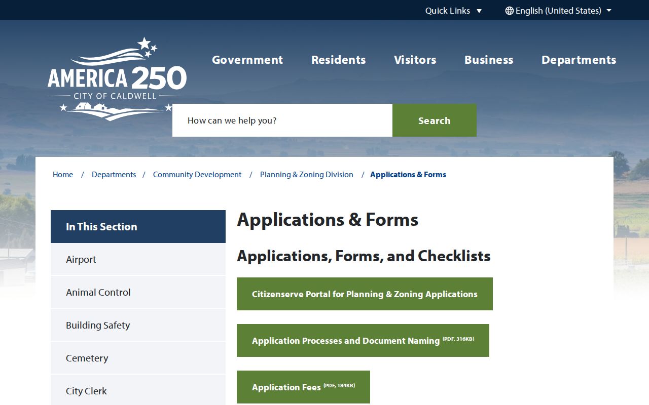
The captured page shows the official planning route. These files give dated civic evidence, not a standing list of everyone on a street. A 2026 Idaho Attorney General warning noted forged permit invoices using real Caldwell project facts, so verify payment requests by a published city number.
Caldwell Streets Are Not Rolls
Idaho voter records can carry a registered name, residence and mailing address, county, gender, age, party, optional phone, and election participation history. They do not disclose a ballot choice, full birth date, signature, Social Security number, or driver-license number. The individual VoteIdaho lookup is narrow and current; it is not an open street browse.
A permitted full report may use county or precinct scopes, but Idaho law restricts public voter data and bars turning it into a generic mailing or telephone list. Address Confidentiality Program participants and protected voter information remain shielded. For a lawful file request, contact Canyon County Elections at 208-454-7562 and state the intended use.
Use a voter result as dated registration evidence. It does not prove that every person at an address appears or that the voter remains there today.
Caldwell Street Grid Through Time
Caldwell began as an 1883 railroad townsite. Historic-district research describes a rail-oriented grid with blocks about 300 by 256 feet, 16-foot alleys, and 80-foot street rights-of-way. The official 1961 city map bridges older directory wording and current mapping. No verified citywide renumbering year was located, so a mismatch should not be explained with an invented event.
Compare old street spelling, original plat, legal description, historic map, current city map, and county road-name table. Early entries may use rural routes, railroad wording, town or county labels, abbreviations, or misspellings. The Assessor’s parcel style, including its final character, is a modern key that should be copied exactly.
For the historical shelf itself, use the Caldwell city directory collections. The street page uses those volumes only as an address-to-date clue.
Request Missing Caldwell Street Records
When an index fails, use the custodian that owns the record. The Assessor and Recorder offer in-person, phone, and written-copy routes. City Mapping and Planning address incorporated street, permit, and subdivision files. County GIS or Development Services handles many unincorporated address and centerline questions. Caldwell Public Library’s Idaho Room and the Idaho State Historical Society cover old directories, newspapers, maps, and microfilm.
Write a narrow request. Include the exact street address, parcel number, legal description if known, department, record type, and date range. Ask to inspect rather than buy copies when inspection will answer the question. Idaho Public Records Law allows exemptions and redaction, and copy or labor charges may apply after no-cost allowances.
For city records, the Clerk accepts written requests and offers portal, hard-copy, mail, email, pickup, and inspection paths. The stated initial response is three business days or notice that more time is needed, up to ten days under Idaho Code section 74-103.
Caldwell Street Directory Limits
A renter, relative, or household member may be absent from every public index. Utility customer data, motor-vehicle addresses, protected voter records, and other confidential fields do not become public merely because a street is known. A vacant, farm, institutional, or business parcel may also look like a home on a simple map.
Commercial neighbor tools may merge public and marketing data, retain old addresses, or confuse people with similar names. Official records retain the custodian, date, and document context needed to test a claim. Even then, a person named in a deed, permit, voter record, or old directory has only the role shown by that source.
Lawful use. Caldwell address records are for lawful personal and civic research. Never use them to stalk, harass, threaten, or expose a protected person.
A sound Caldwell street directory result states what is known, when it was recorded, and what remains uncertain. That restraint is part of an accurate search.